This many mountains is just insane to me. Prior to this trip, this was not what I pictured when I thought of Oregon. This was downright RUGGED! And it was gorgeous. The three mountains in closest proximity to Black Butte, and to one another are the Three Sisters for which this area is named: Middle Sister, North Sister, and South Sister. All three of these mountains are sleeping volcanoes. The North and Middle Sister last erupted ~14,000 years ago and scientists think it’s unlikely that they’ll ever erupt again. However, the South Sister erupted as recently as 2,000 years ago, and could feasibly erupt again. There have been sporadic reports of volcanic rumblings deep within South Sister since 1866, and there have been a couple of minor scares since the late 1980s. Nothing has ever happened, but there is a big pot of magma a few miles beneath the peak of South Sister. Did I mention that South Sister is also the easiest of these mountains to climb? Sign me up for that!! 😵
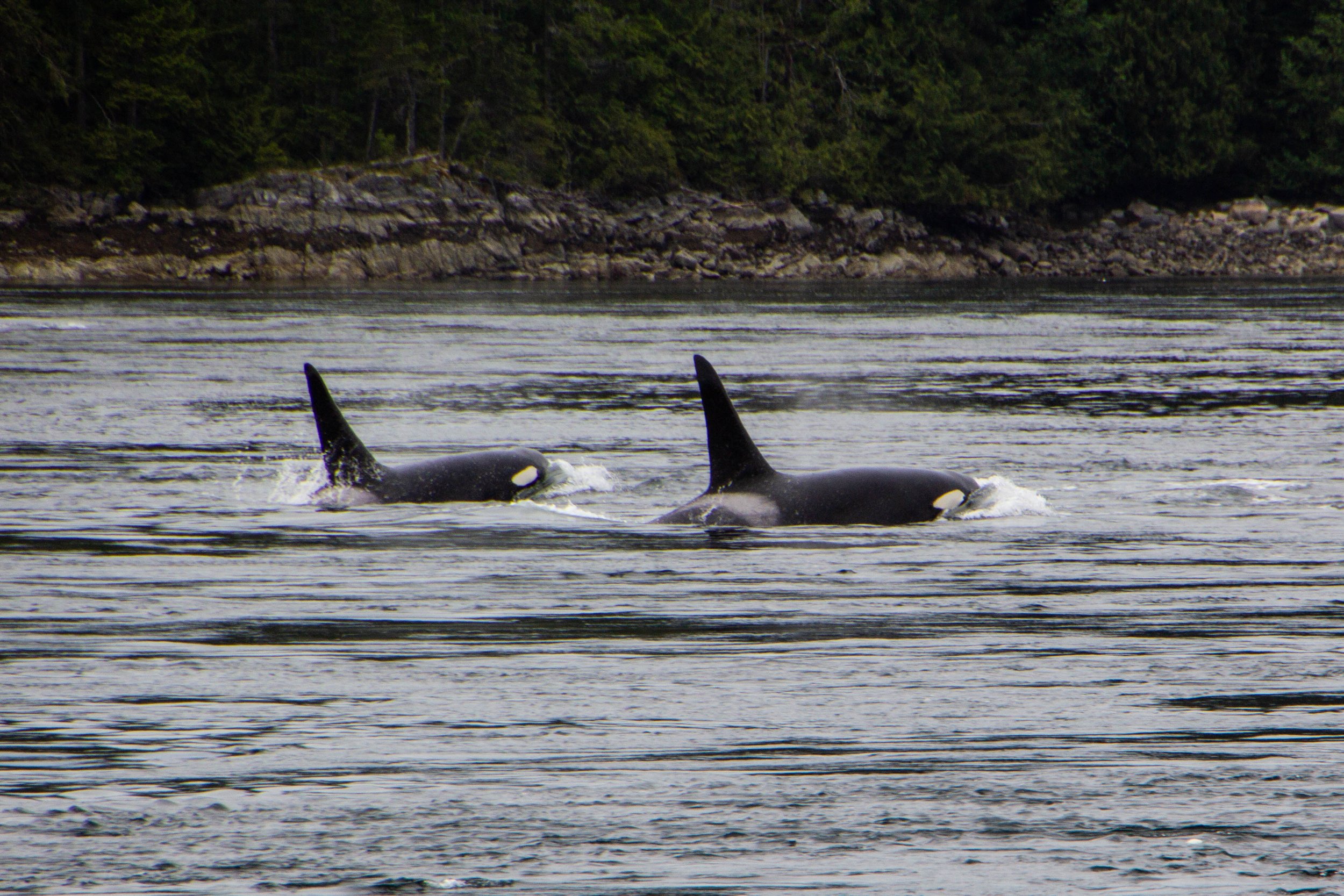
Orcas, or Killer Whales, were something of a feared creature in the olden days. Apparently, back in the 1800s when this part of the world was first being explored by Europeans, their technical/scientific classification was actually “Monster.” Hilarious as this might seem, it does make some sense. Black whales with sharp teeth and shark fins? Yeah, that would have definitely felt somewhat monstrous to me if I was an early sailor of these waters. The conventional wisdom of the day was that, if you fell in the water, you needed to get out ASAP so an Orca wouldn’t eat you. If you hadn’t already guessed this, there is, in fact, no record of an Orca ever eating a human. But this was still a legitimate fear as recently as the 1960s when they actually mounted a machine gun on a coastal bluff known as Chatham Point with the aim of shooting as many Orcas as possible. 🤯 Somehow, for the time when this gun was actively scouring the seas, the Orcas stayed clear of this area and there were no casualties. So Orca/human tensions have never escalated to be anything more than a cold war. And it was not long after this that human sentiments toward Orcas began to change for the better.
In the last article, we checked out Sombrio beach, which I think is likely the most easily-accessible stretch of coastline in the Port Renfrew area, and also the place that resembles the classic “beach” (i.e. sand, waves, etc) most closely. However, the majority of Vancouver Island’s coastline is not as easy to access and is NOT your classic sandy beach. This is a rocky, mossy, rugged, chaotic, windswept boundary zone, perpetually pounded with massive waves, riddled with lively tide pools, and entirely unaccommodating to the “beach vacation” experience. It’s also extremely cool.
To give you an idea of exactly how isolated this place is—the one gas station in the area was out of service during our visit, so we had to drive 2.5 hours EACH WAY to get to the next nearest gas station. We had been advised to stock up on groceries in Victoria before coming out here because we’d have to travel similar distances to find a supermarket. Also, Port Renfrew apparently experiences random rolling blackouts from time to time. When the power went out on our last day, we stopped by a local hotel & restaurant that had a generator running to ask how long these blackouts usually lasted—they told us that the last one lasted 2 days. 🤯 Suddenly, the flashlights we found waiting for us in our Airbnb made a ton of sense. That’s part of the deal out here!
You can’t actually drive all the way out to Tomales Point. There’s a parking lot and a trailhead next to the historic Pierce Ranch. From there, it’s a 9.4-mile round trip hike to get all the way out to the tip and back. Over the course of this route, there’s a total elevation gain of 1,177 feet. Honestly, it’s a pretty easy hike. I did this when I was fresh off a particularly rough COVID infection, still trying to get my mojo back, so this should give you no pause.
When you picture LA, what comes to mind?
I’m guessing that most of you didn’t say “mountains.” Or maybe all of you did and I’m the one who wasn’t “hip”. But the following was actually news to me: LA is actually surrounded by some formidable topography! And a lot of it is a lot closer to the city than you might think. The map below shows the terrain in 3D, and you’ll see that there are a number of different mountainous areas to be considered here, but today we’re going to be in the one highlighted in blue. Those are the Santa Monica Mountains.
The Caucasus Mountains don’t hold many superlatives or titles because, compared with other major mountain chains like the Andes or the Himalayas, they’re boxed into a pretty small area. They also rise up basically straight from sea level (they border the Black Sea to the west and the Caspian to the east), so there was virtually no chance of them having the highest anything. Compare that with the Rockies—driving west across the U.S., by the time you get to Denver, which is still in the Great Plains, you’re already more than a mile above sea level! So the Caucasus range flies below the radar, but once you get yourself into the middle of it, it’s pretty overwhelming. It is a world unto itself, with all sorts of interesting secrets and idiosyncrasies. Today we’re going to focus on glaciers.
This quest brought us to the edge of the world, literally, to the bone-chillingly massive cliffs of Látrabjarg. Here’s a spoiler alert for you: it was mind-blowingly gorgeous. A friend of mine recently pointed out that I’ve said similar things about a great many of the places I have visited, so let me up the ante a bit: this was one of the top 5 most beautiful places I’ve seen, EVER.
At 18,380 feet (or 5,602 meters) above sea level, Khardungla Pass is the highest motorable road in the world. To put altitude in perspective for you, that's almost 13 times the height of the Empire State Building. It's a little less than the length of 115 (American) Football fields. It is the equivalent to about 3.5 miles. It is also 780 feet higher than Everest Base Camp.
So let's get into it!
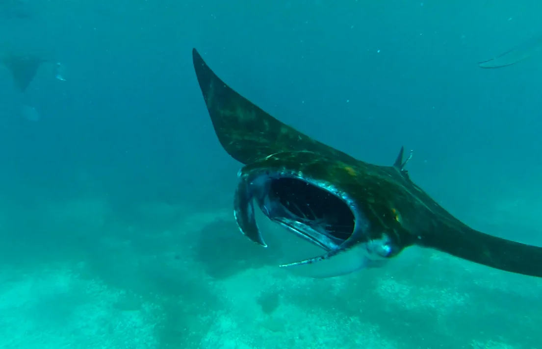
We sailed further into the islands to a place called ‘Manta Point.’ This place was famous amongst divers for, you guessed it, manta rays. As far as I could tell, Manta Point wasn’t really an actual ‘point’, rather just a large area of water in the middle of the Komodo Islands. Our boat slowed down as we approached Manta ‘area.’ The crew leaned off the deck, scouring the clear, blue water. Then there was a shout. Off in the distance what looked like a large fin broke the surface. As we continued I could see big dark patches moving around beneath the boat and obstructing the purity of the water's light blue coloring. These were manta rays. I was so jazzed that I jumped in with no sunscreen, which was a terrible decision, but I was busy swimming through this...