

When you picture LA, what comes to mind?
I’m guessing that most of you didn’t say “mountains.” Or maybe all of you did and I’m the one who wasn’t “hip”. But the following was actually news to me: LA is actually surrounded by some formidable topography! And a lot of it is a lot closer to the city than you might think. The map below shows the terrain in 3D, and you’ll see that there are a number of different mountainous areas to be considered here, but today we’re going to be in the one highlighted in blue. Those are the Santa Monica Mountains.
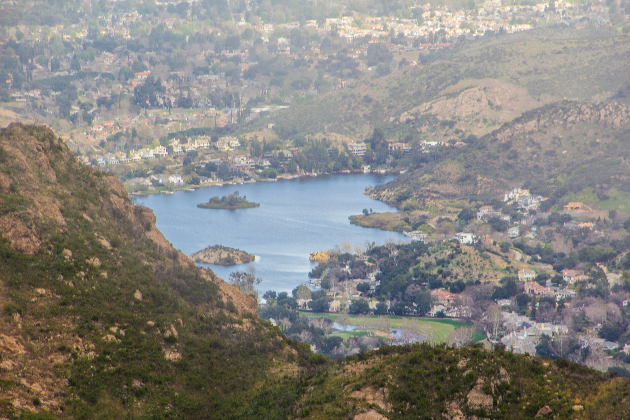
There are pieces of these mountains that are actually quite iconic because many of LA’s most famous neighborhoods are nestled in or against the foothills of the Santa Monica Mountains. One notable example with which you will undoubtedly be familiar is the Hollywood sign. That thing is mounted on one of the foothills, and looks out over West Hollywood / the fabled ~Hollywood Hills~. Wind your way further up into these hills and you’ll be in Beverly Hills and Bel Air. Westward down closer to the coast, Santa Monica is nestled right up against these mountains. From there, if you wind your way up the coast on Highway 1, you’ll be in Malibu. This is some EXPENSIVE real estate. People who live in and around these mountains tend to be quite comfortable. 💅

It was early on a Saturday morning in March when we were set to venture out into these mountains for a hike. As we piled into the car from a bagel shop in Silver Lake, I had visions of luxury in my mind. Mountains surrounded by Malibu, Beverly Hills, and Bel Air? How mOuNtAinOUs and rUgGed could this place really be?
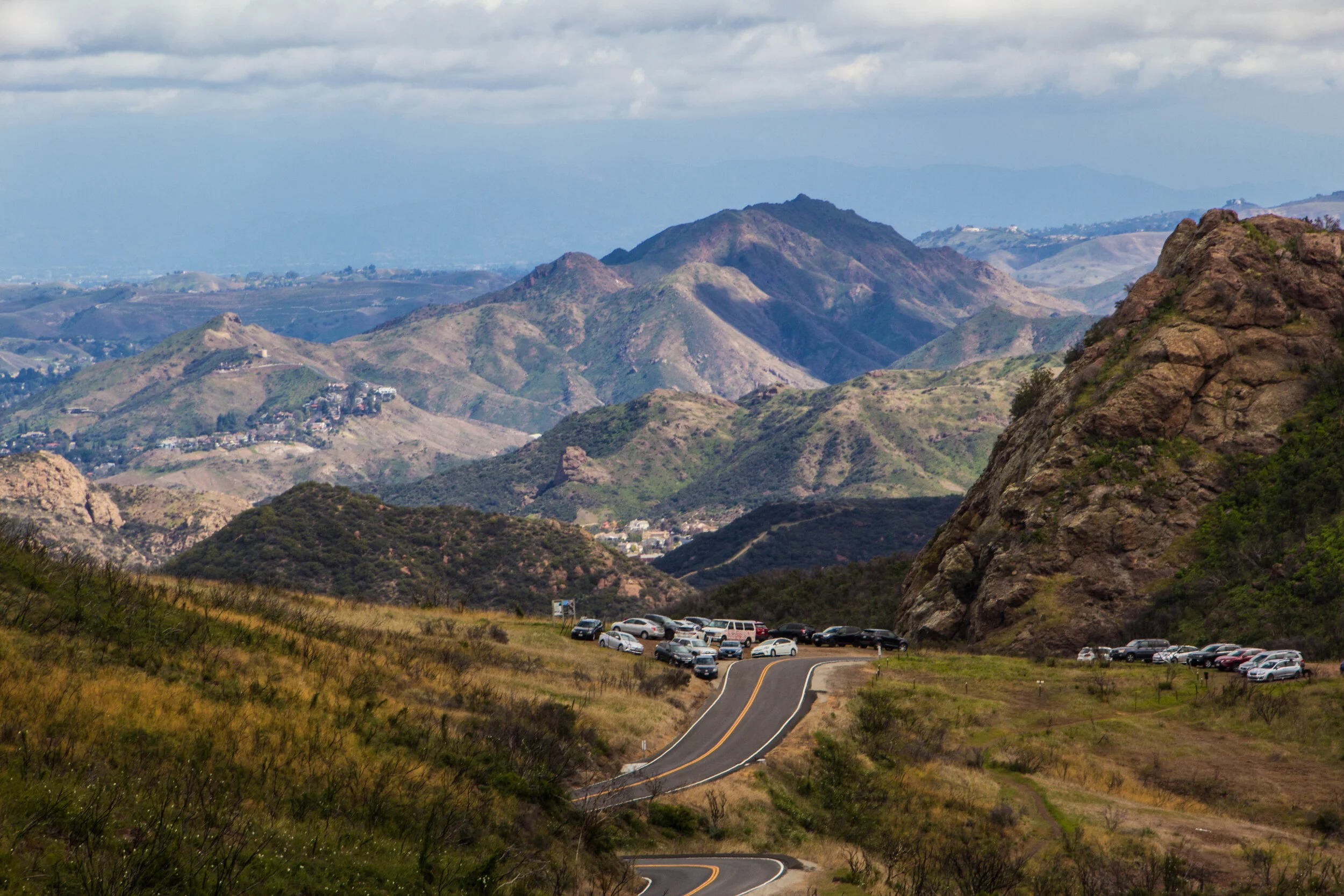
Fast forward 45 minutes and we were rocketing down winding mountain faster than I think any of us would have liked. There were stretches of cliff-side road with hair-pin turns that made my palms sweat. Finally we rolled to a stop on the shoulder of the road, just a few feet from a steep, rocky drop. We had arrived at the trailed head of the Sandstone Peak trail.
Hiking The Sandstone Peak Trail
The Sandstone Peak trail is 6.25 mile loop that covers 1,075 feet of elevation gain, eventually bringing you to the trail’s namesake, Sandstone Peak. At 3,111 feet, Sandstone Peak is the highest point in the Santa Monica Mountains, and the trail to get up there offers some incredible panoramic views of the mountain range. Almost immediately upon starting the trail, we came to a deep valley, on the other side of which stood a sheer rock face. From far away, it was hard to grasp the scale of it, until I realized that the couple of specs crawling across the middle of it were, in fact, PEOPLE. There’s some surprisingly big mountains out here!


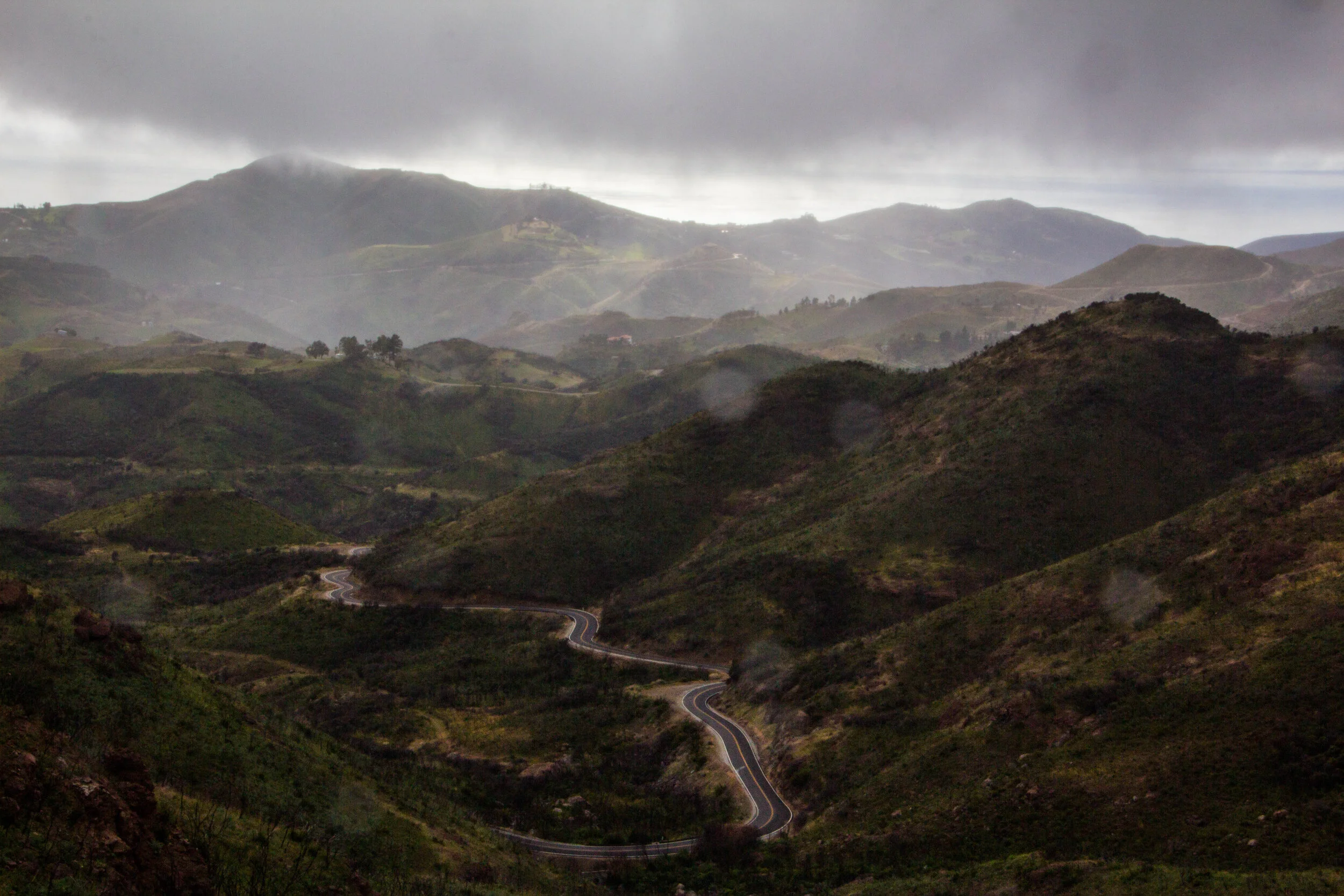
As we pushed forward, the clouds overhead began to change. We were like 0.2 miles shy of halfway through the trail when we were enveloped by a thick sheet of fog and light, gusting sheet of rain. Since none of us had rain gear, we debated turning back and saving ourselves the net 5 minutes of walking, but in the end we decided to push forward. CUZ WE’RE MEN.
By the time we actually got close to Sandstone Peak, the visibility was basically zero. I wasn’t sure that I’d even post this because of the low visibility, but then COVID-19 happened, so what the hell else am I gonna posted about? I’m only bothering to share photos that were cool in some way. The whole experience was made a bit eerie because it hadn’t been long since some legendary California Wildfires had completely engulfed these areas. So everywhere we went, there were large swaths of trees that were black and charred.


The descent back to where we had left our car yielded probably the best views of the whole excursion. Since we were right at cloud-level, much of this portion of the hike was split screen between beautiful view down into the valleys below us, and swirling gray clouds. In spite of the inclement conditions, I managed to catch a few nice shots here and there. I did my best to clean them up for you below.


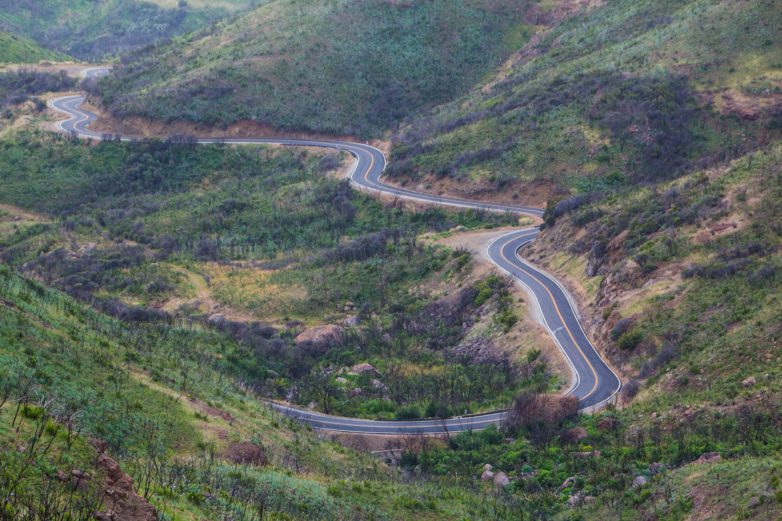

The hike as a whole wasn’t difficult, but there were definitely a few spots where we had to scramble up precarious rock-falls. Save for those small pieces, it was all quite doable! What turned out to be less doable was the drive down to Malibu. I’m literally carsick thinking about it. And I had the front seat! My poor friend in the backseat had a much worse go of things. We almost had to pull over, but in the end he opted to tough it out so we could just get to the bottom faster. MEN!
Once we got back down to sunny Malibu, all of that terrain, weather, and motion sickness felt worlds away. Down here on the beach, it was cool and sunny. We stopped into a restaurant to recover from our adventures, and then went out looking for a public beach in Malibu. That turned out to be quite difficult to find since nearly all of the oceanfront land is privately owned, but eventually we found our way onto the sand. It was actually freezing on this beach though, so we didn’t stay long.


From there, we rolled over to Santa Monica to swing through somebody’s apartment for some tea. By the time we got over there, the colors in the sky were starting to change. Evening was coming. And from the the balcony of a small apartment, sipping a glass of Taiwanese tea, among friends, watching the light change over the rooftops and palm trees, I felt pretty lucky. Good vibes.
LITTLE DID I KNOW THAT THIS WOULD BE THE LAST TRIP I’D BE ABLE TO TAKE FOR A WHILE!
Enter COVID-19. The very next week, the WHO officially declared that coronavirus was a pandemic. Cue the Curb Your Enthusiasm music.