

YEAH LET’S DO THIS F*CKING THING!
After my trials and tribulations on the slopes of Black Butte, I was ready to take on the world! And I was fired up to see more of this place that had absolutely sucker punched me with its unexpected beauty: Central Oregon. There was no shortage of beautiful hikes at our fingertips, but I was hoping to avoid another death march straight up the side of a mountain. After some discussion, we landed on a hike called the Tam McArthur Rim Trail, which was supposedly a bit easier.
Shout-out to Buddy & Erica for being my hosts, guides, and bros. ✊
Hiking Tam McArthur Rim (Attempted)
Hail pelted our car and bolts of lighting rocketed violently into the forest around us from the clouds hovering menacingly just overhead. We were arriving at Tam McArthur Rim… and the weather was not cooperating. Being in a thunderstorm at such a high altitude was intense. The points of origin for each of these flashes of lightning must have just been a few hundred feet over our heads. There was barely any delay in the deafening thunder that followed each flash of light.
When the weather allowed, we did hop out of the car for a quick look around. We still had some hope that this hike would happen. But the freezing cold rain quickly convinced us otherwise. Nevertheless, I did get a few cool pictures of Three Creek Lake with steam coming off the water as the cold wind and rain battered its surface. It was pretty cool.
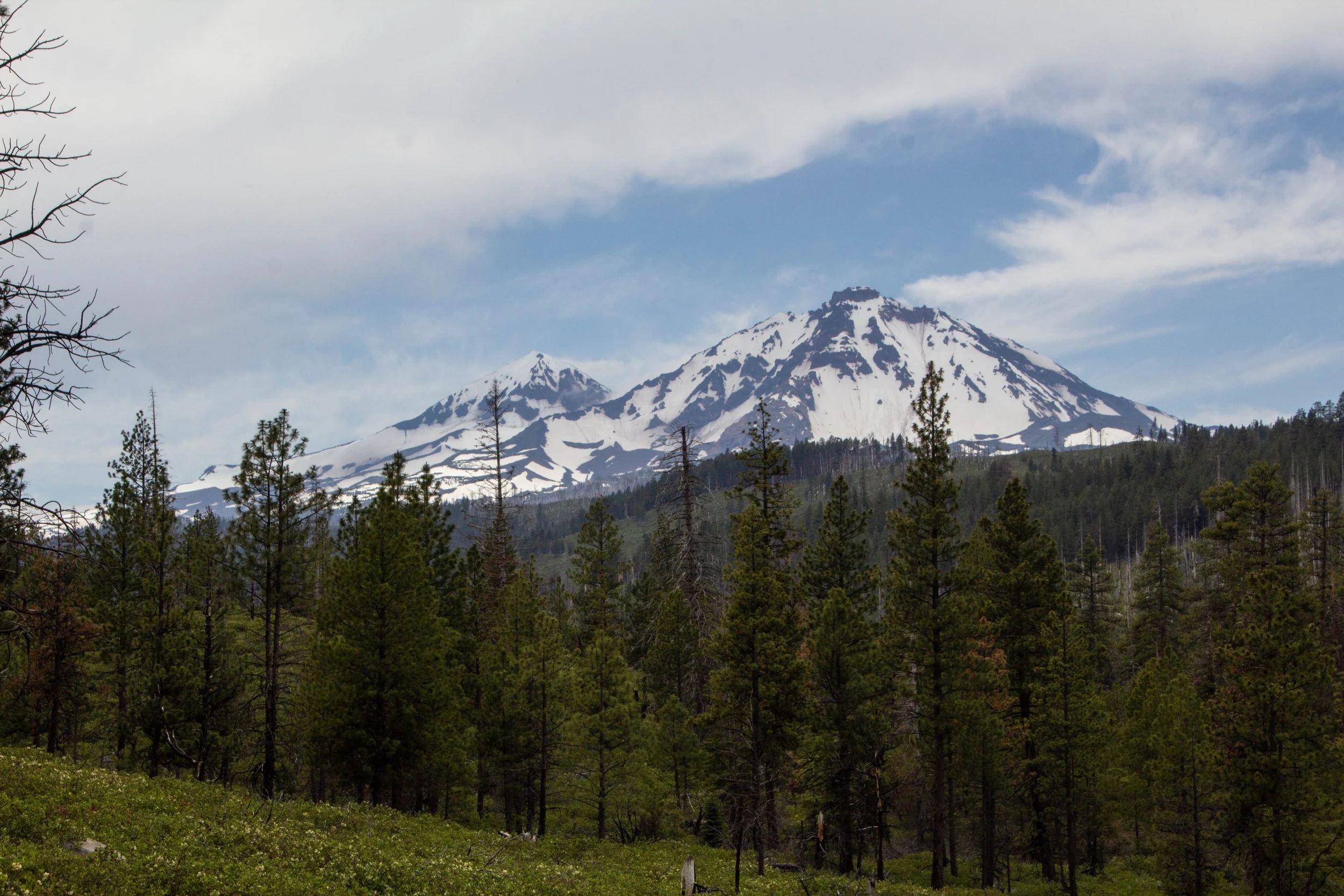
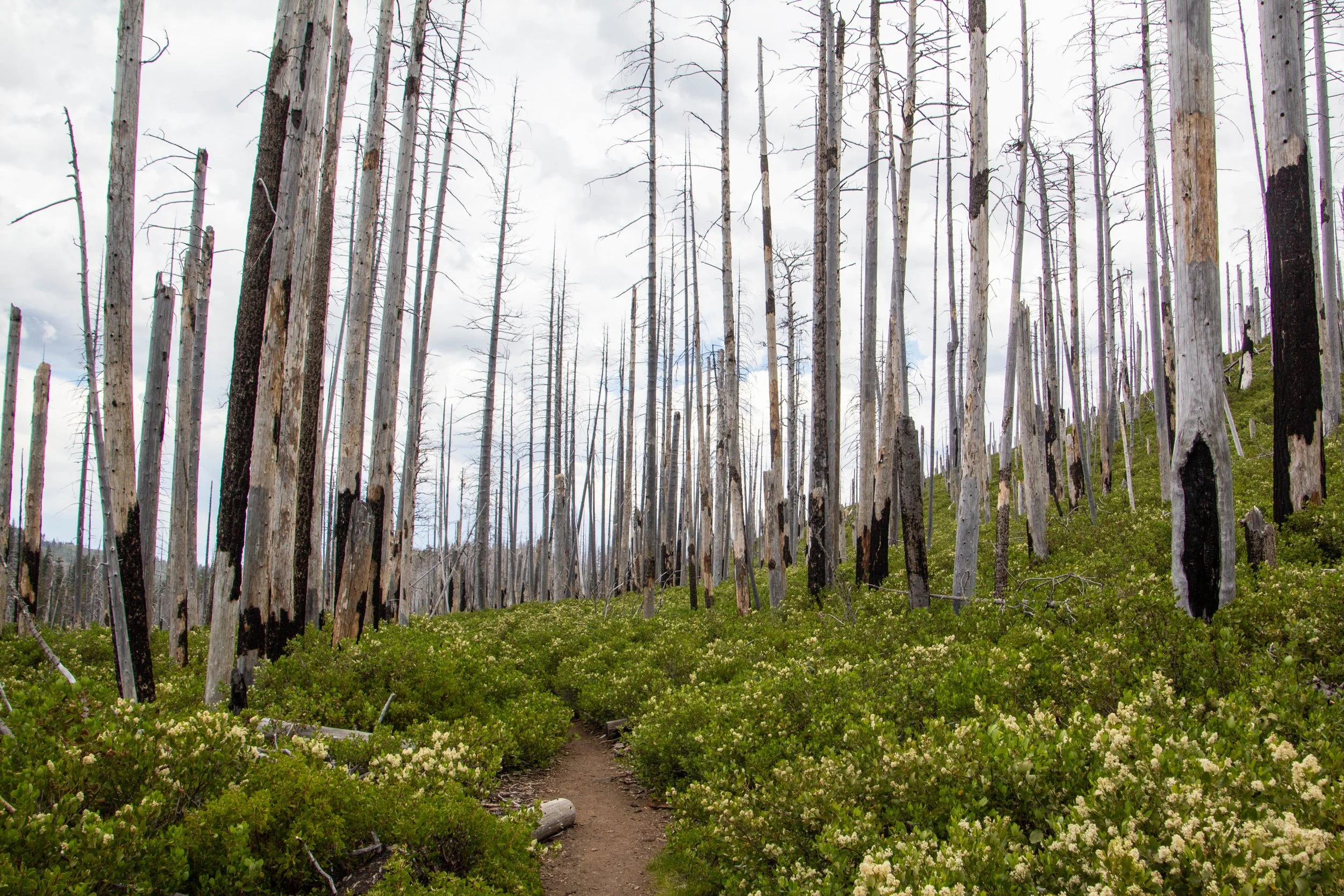
We retreated back down the road a bit to a place where we had driven past a great panoramic view of the Three Sisters Mountains. We found a small dirt road and parked at the top of it. The view from this spot was especially clear because the forest cover seemed to have been burnt up in a fire. So, while the mountains were as beautiful as ever, their foreground felt like a muddy, deforested dystopia. As I said in previous articles, I think that the cycle of forest fires is a legitimate part of the ecosystem out here, so this might not be related to climate change at all. Mother Nature really did intend for this area to burn up every so often… but damn. Under these stormy skies, it was as striking as it was bleak to behold.


This is where—if I had been left to my own devices—my day would have probably ended. There was no cell service up here, so I would not have even been able to Google other hikes to do, much less check the weather radar to see which of these hikes would even have been feasible. That’s where my local guides came through for me. Somehow they knew not only a good alternative hike that was likely clear of weather, but they also knew how to navigate the vast array of dirt roads out here without maps to find the trailhead.
Trekking Chush Falls
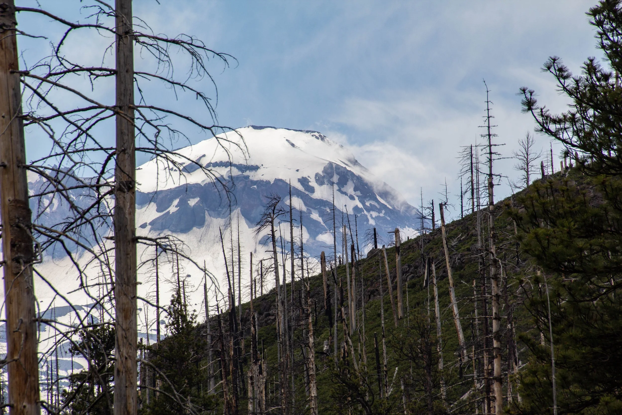
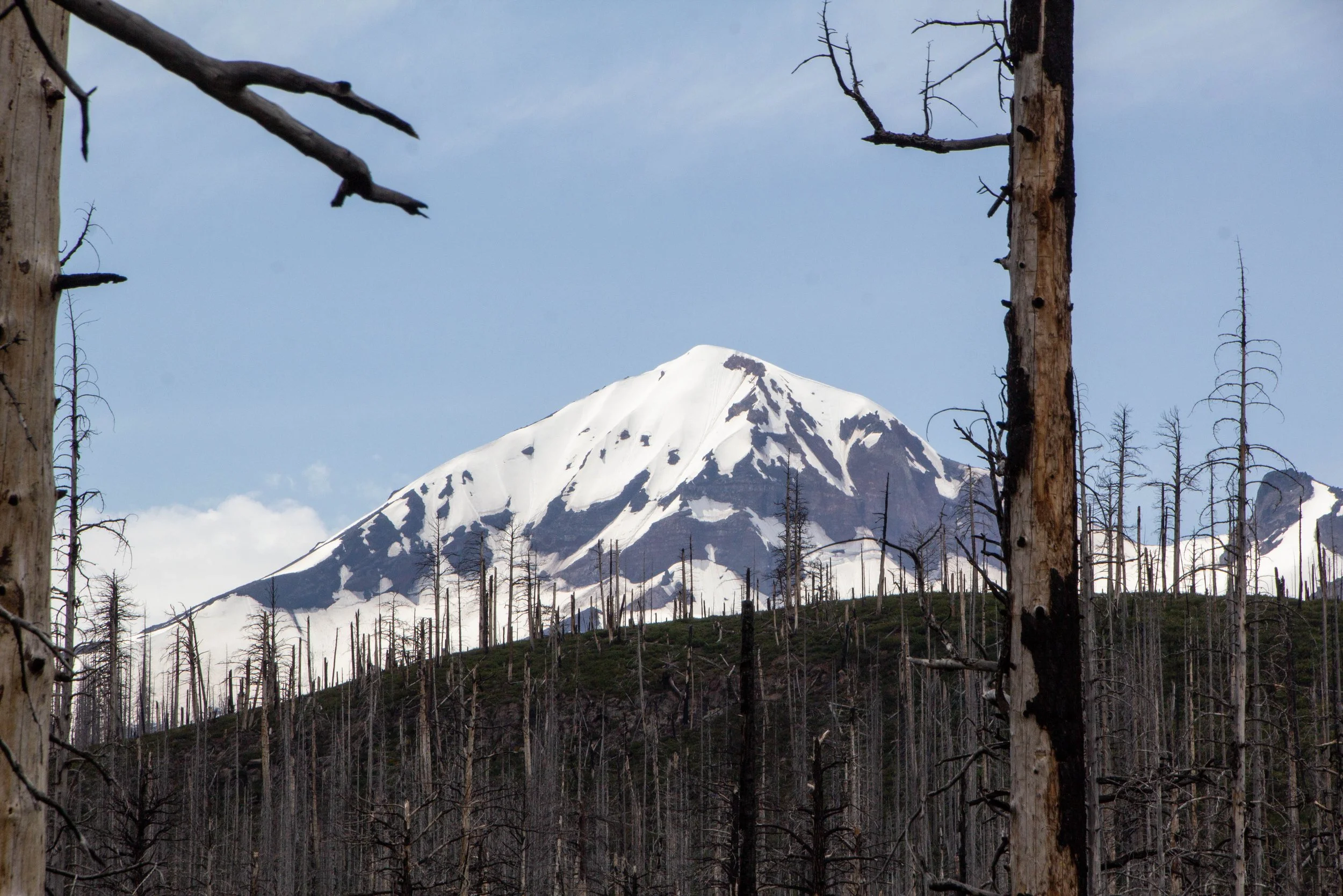
Chush Falls (pronounced “shoosh”) is actually nestled right up against the Sisters Mountains and Broken Top. The drive to get to this trailhead was about an hour from Tam McArthur Rim, all over gravel roads. Oh, and it was absolutely STUNNING. Honestly, even if you don’t do this hike, the drive is still well worth the effort. This was already bringing me closer to these mountains than I had yet been. Looking up at the snowy slopes, I could see every little rock and wisp of cloud clearly and was able to even capture some of this with my camera. And, miraculously, the weather really was clearer over here.


Before we dive into this hike, here’s a quick look at the all the super-official trekking details from AllTrails.
The hike from the trailhead was actually quite easy—especially compared to my grueling experience on the slopes of Black Butte. The trail was mostly flat-ish, as it wound its way through the charred remains of what had once been forest. In the sunlight, these burnt forests went from dystopian to enchanting. The white tree bark was a striking addition to the already-vibrant color palette of this place. When the swirling clouds overhead parted to let the sunlight through, it felt like somebody turned up the color saturation in my eyes. Suddenly the thick bushes on either side of the trail were a brilliant shade of green, and the many wildflowers that had been serving as quiet accents got much louder. In the distance, the bright blue skies lit up the snowy caps of the South Sister. Honestly, I could have walked through this all day long.


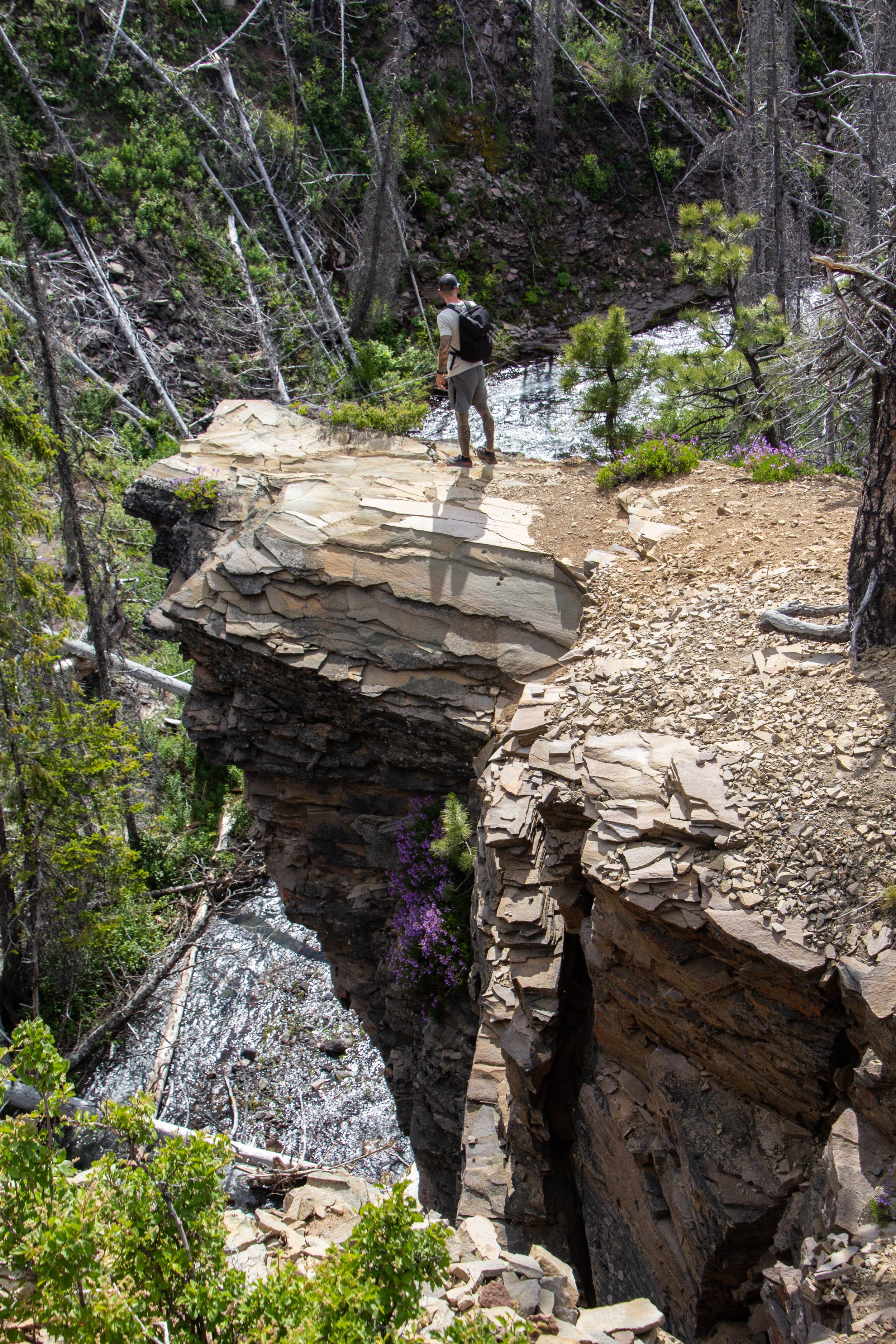
After a relatively easy 2.5 miles, the Chush Falls trail ends unceremoniously on the edge of a steep canyon. The roar of a waterfall was audible through the trees, but it was not immediately clear where exactly that waterfall was.
“So, um, where’s the waterfall?”
There were a few kids who were at the end of this trail as well, probably between the ages of 13 and 17. The youngest of them hopped over and enthusiastically explained to us how to get ~extra~ close to the waterfall. Honestly, it was a helpful tip. 😂
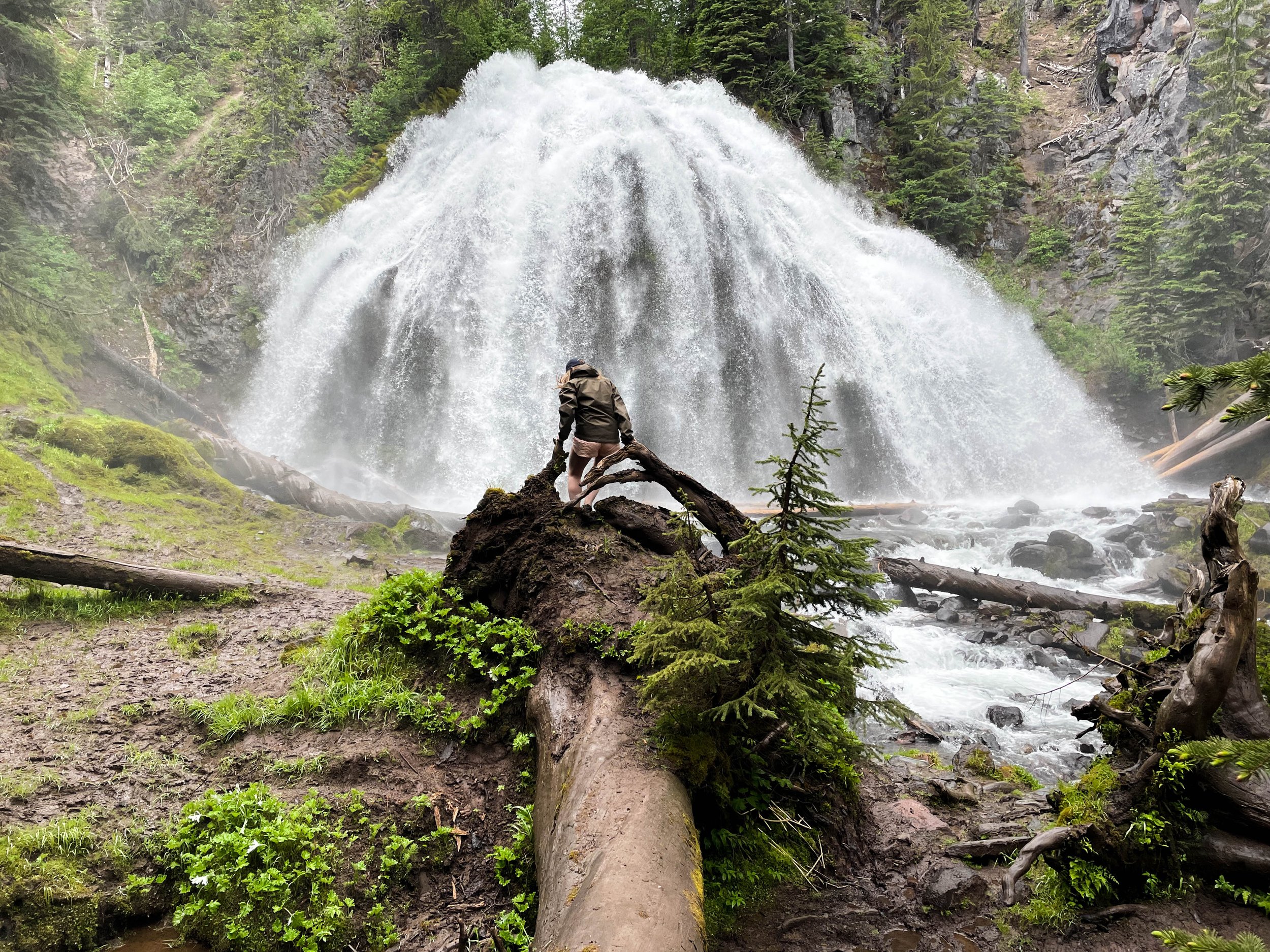
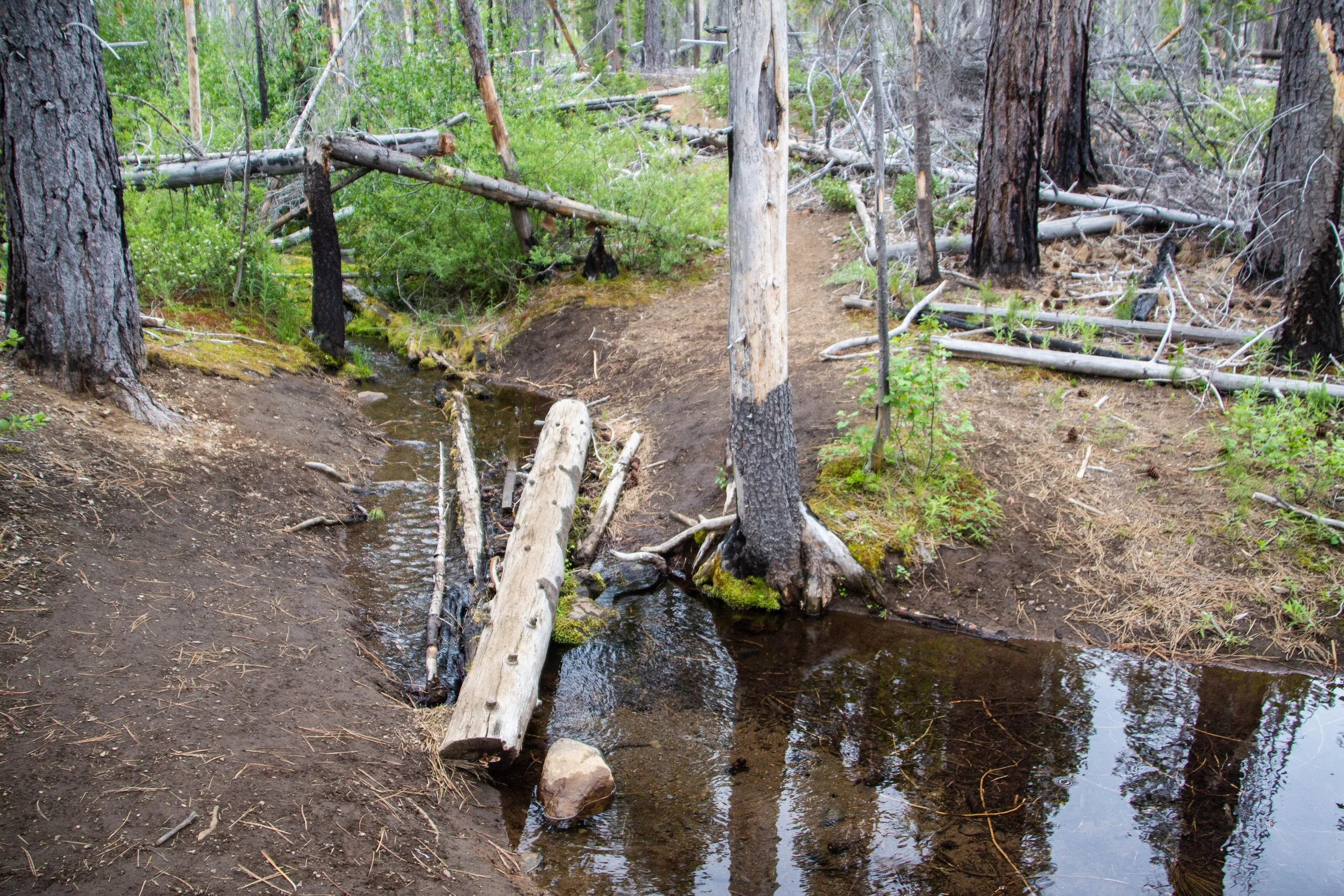
So, here’s the catch with hiking to Chush Falls. In order to actually get to the waterfall, you have to shimmy down a steep slope of loose dirt and mud, and then find your way through a thick layer of foliage to the side of the river. Although it’s clear that people do this often, that doesn’t make it easy. Whoever built the trail to get out here had clearly made no attempt to get hikers down to the actual waterfall. So, with a shrug, we started down the steep slope, into the forested gorge. The slope was so steep that I was forced to rely heavily on the few skinny trees whose roots were holding all of this soil in place. Still, the soil was quite loose, and it was not long before I slipped and fell down. By the time I got to that final layer of foliage, my whole backside was covered in dirt.
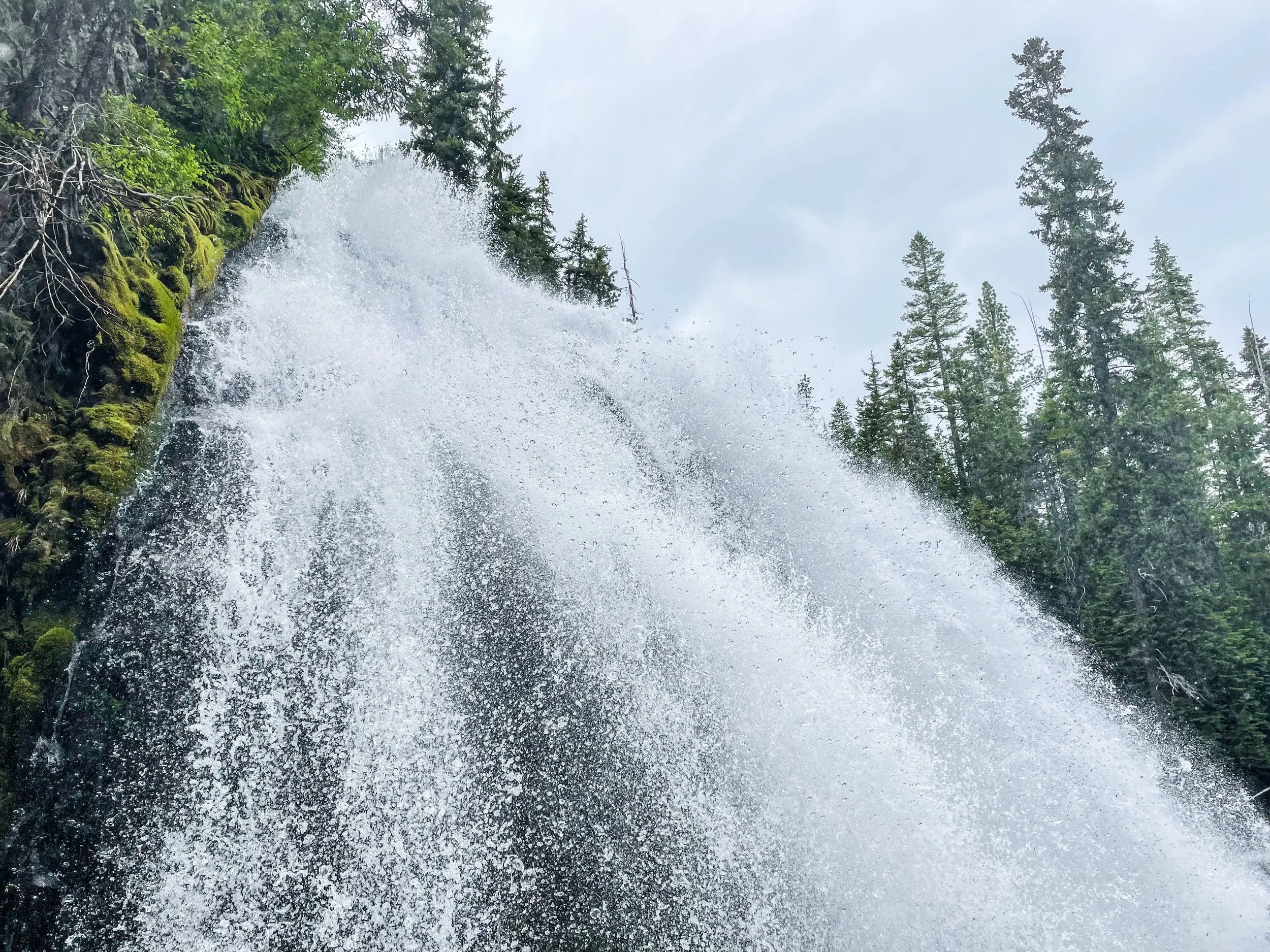
We pushed our way through tree branches and bramble to find ourselves on the banks of a small but fast-moving river. We hopped to a little island in the middle of the river and turned to the left. There it was: Chush Falls. I’m not sure what I was expecting… but this was bigger. The roar of the water was intense, and it sent a cold whistling wind of water droplets flying through the ravine like a jet engine. It was surprisingly intense given the distance that remained between us and this waterfall. Naturally, the next move was to shrink that distance.
There was no obvious way to get any closer to the waterfall, so at the outset 1 of the 4 of us opted out of this expedition entirely. My instinct was to join them, but then I remembered how I had gritted my way to the top of Black Butte. Even though I was a bit more timid than usual at this point because of all my struggles with anxiety over the past year, I decided to give this a go.
We plunged ourselves back into the foliage and a path forward was quickly identified. There was a depression in the land full of sharp rocks, fallen branches, mossy debris, and water, over top of which stretched a fallen log. It formed a great bridge over the no-man’s land that lay below it, but it was treacherously slick with water and mud. You can see the view from the foot of that log in the header photo of this article, as well as the gallery below. With the rushing misty wind as a constant force, I took a deep breath and walked out onto the log. I took a couple of steps… and then I slipped AGAIN! My legs slipped over the side of the log and my ass came down on the log maybe 6 inches shy of the sharp broken end of an upward-facing branch.

PUTTING THAT CLOSE CALL BEHIND US, I hopped to my feet and got myself across and off that godforsaken log, and straight into the mud. From there the path up to the waterfall was a muddy, slanting path worn into the side of a steep slope. It did not look like a smart place to walk, BUT I HAD ALREADY COME THIS FAR. I followed my compatriots as close up to the waterfall as we could get.

The force of the water coming over this cliff was truly humbling up close. Check out the mist that goes rocketing outward in the GIF above. There is not a dry leaf within 1,000 feet of this place. Everything is covered in moss, mud, and water droplets.


I definitely slipped and fell at least one more time before I escaped from this canyon. When I finally re-emerged from this crevice, pulling myself back up that dirt slope by grabbing the trees that we unlucky enough to be growing along the makeshift path, I was COVERED in mud and dirt. My shoes and legs were actually completely caked in a thick layer of mud up to my shins. The rest of me what just extremely dirty. I remember somebody in our group (all of whom were locals) commenting that it’s not a trip to Central Oregon if you don’t end up covered in mud at some point. I don’t know why, but that quip really stuck with me. I like that. It weirdly warms my heart to think that this was part of the quintessential experience.
I have touched on this theme often, but my time in Central Oregon really did feel like a watershed moment in my struggles with anxiety. It had been a really hard year, and I was only recently getting back in the saddle with travel again. My trip to British Columbia a few weeks prior to this had had a difficult start, but the weeks I was there had been a really empowering experience. Now, here in Oregon, I was continuing on that path and my experiences out here in the muck of Central Oregon did a lot to remind me that I am, in fact, not fragile! For a guy who had become something of a clean freak over the course of the COVID pandemic, there was something therapeutic about being covered in mud. It was like a baptism.
When we started back up the path, back towards our car, the sun was shining even brighter than it had before. It seemed the inclement weather we had experienced earlier at Tam McArthur Rim was being chased off by a beautiful day. Walking through the brilliant green bushed, amongst the dead white trees was a really unique experience—and quite otherworldly. I made this GIF to show you… it felt like walking through some beautiful video game.

Since I had a pretty good lay of the land now, I did my best to capture as much of this natural splendor as I could during the walk back. I think I was starting to be annoying with how often I was stopping to take pictures, but it felt like a tragedy not to document what I was seeing. I mean just LOOK at these pictures. CENTRAL OREGON!!


I was sad when the time finally came to leave Central Oregon. We got up before sunrise to make the trip over to Redmond, which is the airport nearest to Bend and Sisters. It’s also apparently known to be where all the Republicans live, which makes the name funny. REDmond? Eh? It’s interesting how Bend and Redmond have self-segregated. They all use the same airport though, so the cross-section of travelers that waited for the gates with me is definitely a truer representation of the politics of this region than Bend.
Anyway, this is a small enough airport that there are no large planes waiting at these gates. I had to walk out onto the tarmac and walk up a ramp to board my connecting flight home. Meanwhile, my shoes were still so hopelessly muddy that I had just stashed them into a plastic grocery bag, mud and all, and put them in a separate pocket of my bag. Here are some pictures from boarding that plane at sunrise.


Fun fact: those muddy shoes stayed in that bag for a couple of months after I returned home. Eventually, I washed them off and left them out to dry for another month, but I was procrastinating hard on that. Eventually, I was joking that I should just buy new shoes! 😂
Unsurprisingly, the pictures I took from this hike turned out to be almost unusable because so much water and debris had accumulated on my camera lens. The cleanup of these photos was extremely time-consuming. It makes me itch to think back on it. YIKES.


Thus concludes this series on Central Oregon, and the Pacific Northwest in general! Over the course of the past year and a half or so, I we’ve covered Seattle at length, including Bainbridge Island, Vancouver, big swaths of the Canadian Province of British Columbia, including a great many posts on Vancouver Island, and now have also covered Portland, Bend, and now Central Oregon.
All I can say is…

This is such an incredible region. I would live out here.
If you haven’t been here before, buy a plane ticket ASAP.
At some point during the few hours of travel time to and from these trails, I asked the car what artists they thought should be the “Track of the Day.” Their vote was Volcano Choir. Which is a good pick, I think. So here you go. 👇