

The time has come for my FIRST real California nature experience. I suppose hiking the Santa Monica Mountains a couple of years ago got me into the ballpark, but this was going to be much more immersive. This is the first of two installments on a few days spent in Point Reyes National Seashore, just north of the San Francisco Bay.
WHAT (& Where) IS POINT REYES?
Glad you asked.
Point Reyes National Seashore is a prominent peninsula/cape land formation that juts out of the California coast just north of San Francisco, in Marin County. Bounded by Bolinas Lagoon on the south and Tomales Bay on the north, it’s well known as a beautiful Northern California nature destination. There’s some mildly interesting history here, but mostly it’s just gorgeous. And to raise the geological stakes a bit, the San Andreas Fault is what separates this area from mainland California. That will show up in the pictures I have coming up for you in some cool ways.
It’s 2-3 hours to get up there from San Francisco, depending on traffic and your particular start and endpoints. In our case, we were driving from Haight-Ashbury up to a little town about halfway up the Point Reyes area called Inverness. You can get a rough approximation of the route in the map below.
Getting Up To Point Reyes (via Stinson Beach)
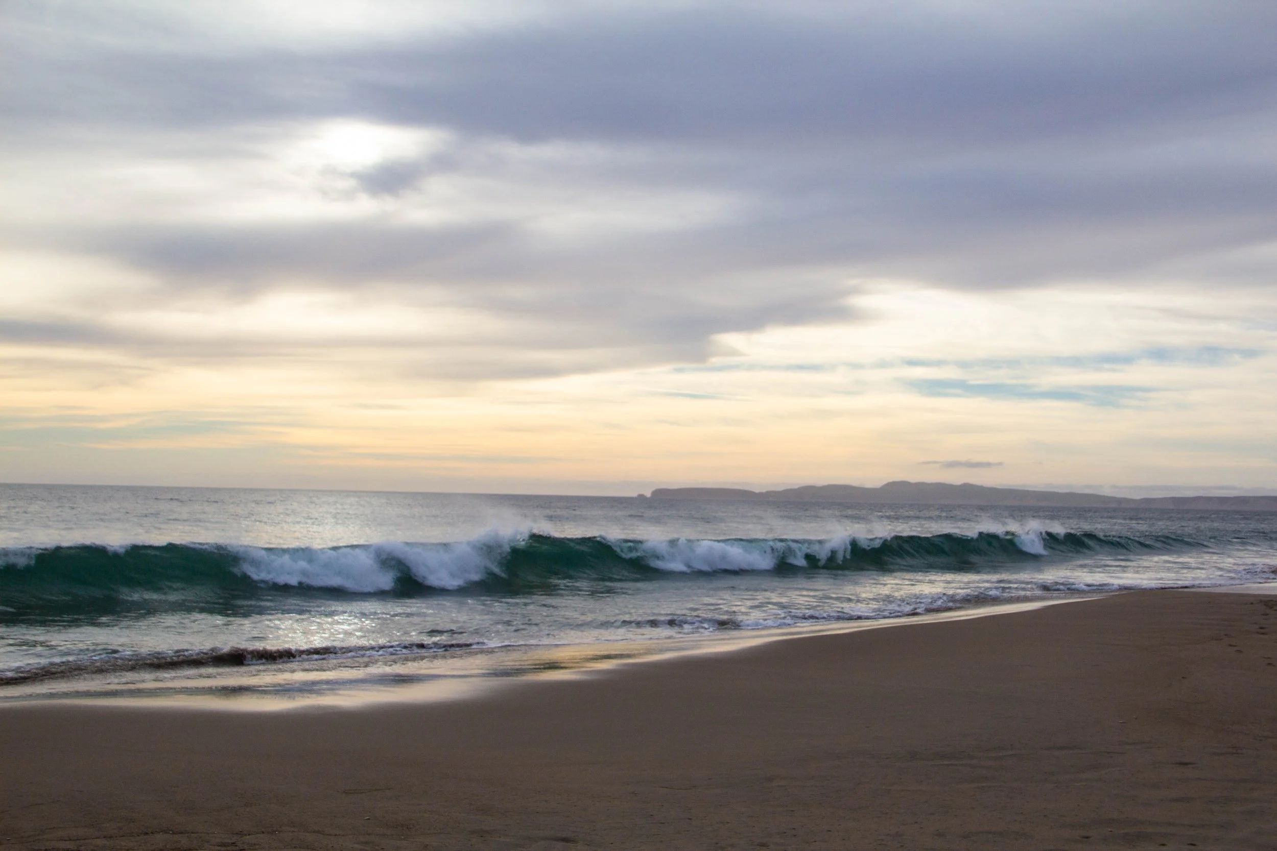
In truth, we didn’t stick to the route above too religiously. We attempted to drive up Mount Tamalpais as a way-point in this trip, but then I got so car sick on the winding roads that we had to pull over, and then plot a different course. We ended up snaking our way up the rugged coastline on a road called Shoreline Highway, cliffs to our right, the Pacific to our left. Our last stop before entering Point Reyes officially was a little spit of land called Stinson Beach. There is a nice little beach town there where we stopped for lunch and to put our toes in the sand. I was struggling with motion sickness as we made our way into this town, but after sitting still for a while I was ready for the rest of the voyage northward.


Point Reyes Towns


Once you’re really out in Point Reyes, it’s crazy how sparsely populated it is. There are lots of little towns on the map, but once you roll through them, it’s surprising that they passed as towns at all. Many of the points on the map only correspond to a cluster of 2 or 3 buildings at an intersection. We stayed in a “town” called Inverness and it might as well have just been the middle of nowhere. But then, that was sort of the point of coming out here: to get away from it all.
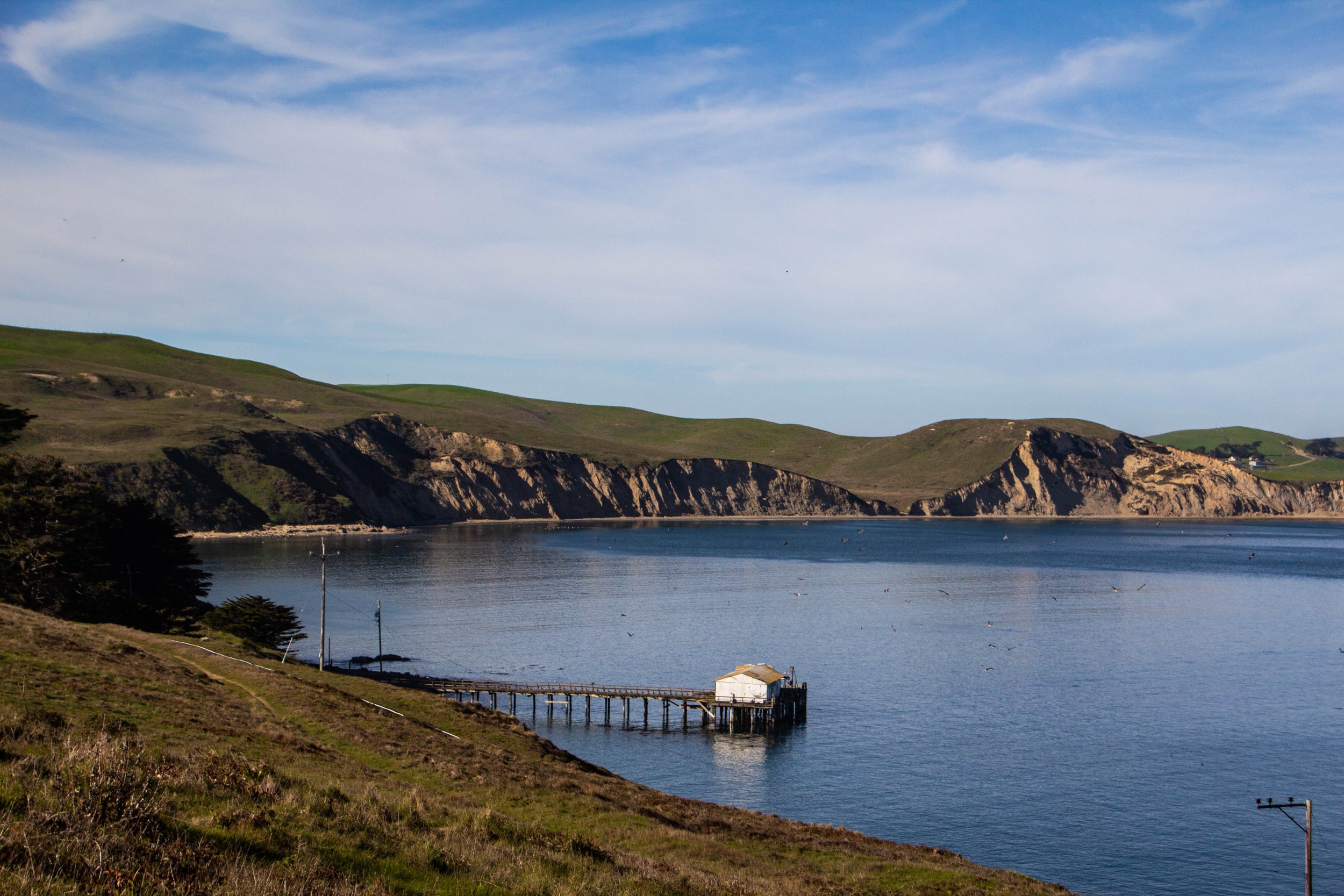
In truth, the only actual town out here is Point Reyes Station. It’s a classic little California town with a population of less than 900. If you just wanted to see the town as quickly as possible, you could walk the whole thing—and I mean every road in the town’s center—in 30 minutes. But it’s actually worth spending a few hours. If you’re in Point Reyes, this is your best option to stop for lunch, pick up groceries, put gas in your car, grab a coffee, etc, so I think it’s best to steer into the skid and explore. It’s a nice place to spend an afternoon. Word to the wise: the only public bathroom in this whole town is at 631 Mesa Rd, Point Reyes Station, CA 94956. You’re welcome. Here are some pictures.


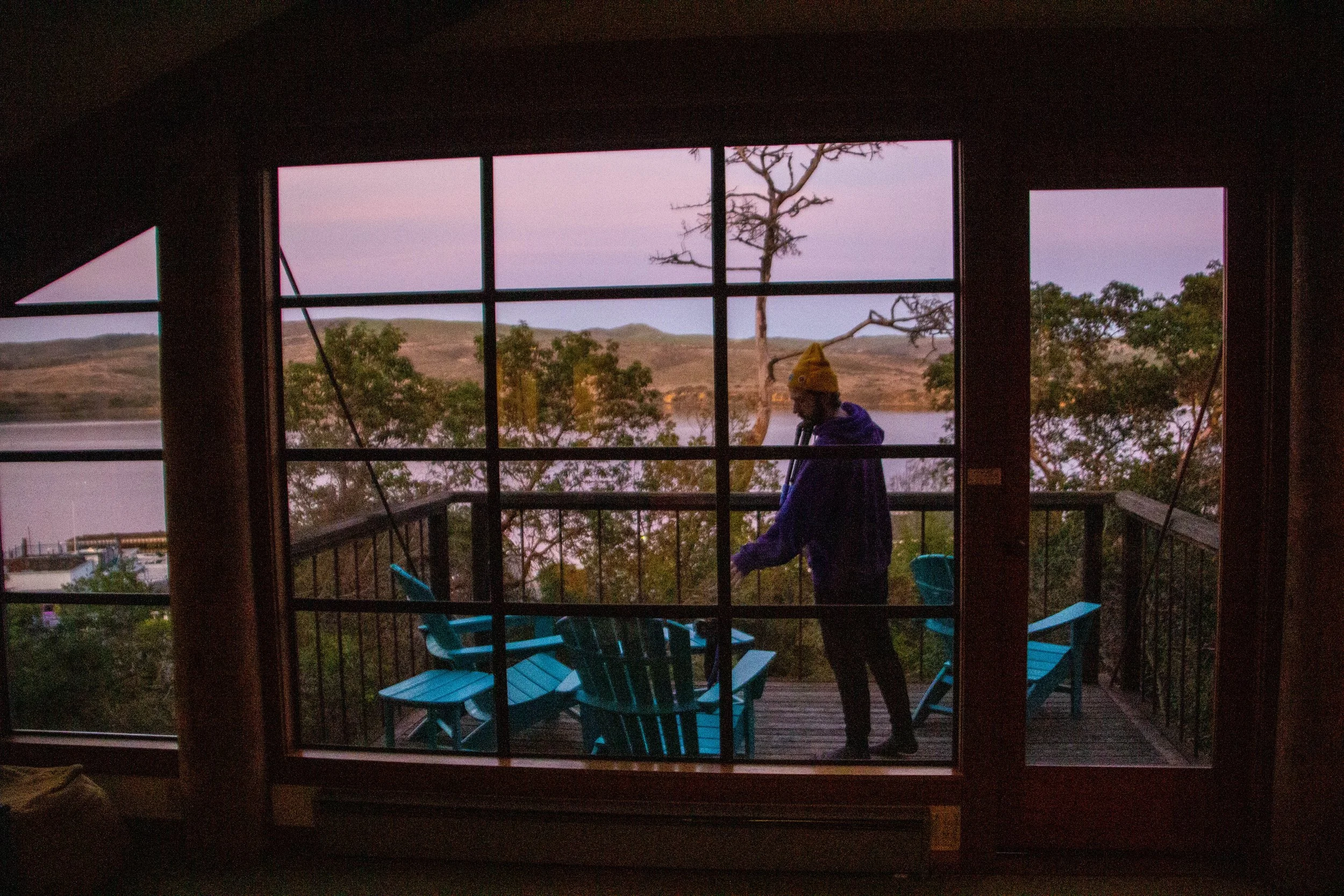
Over the course of our time in Point Reyes, we had to make a number of expeditions to this town and its grocery store so we could cook dinner in the house we had rented. And this house was really a little California gem. It sat atop a small hill and had a balcony that looked out over a pretty stretch of Tomales Bay. The views at sunset were spectacular. It was a perfect spot.
One tidbit that I found interesting was the fact that Tomales Bay literally IS the San Andreas fault. So the photos below are a view from one side of the fault line to the other. People love to talk about how the Bay Area is just waiting for “the big one” so I found myself wondering often during this stay what that would look like from this little nook. It would probably not feel even 1/10th as dramatic as it would back in the city.


Limantour Beach
OK. So let’s get out into some nature. That’s what we’re here for, right?
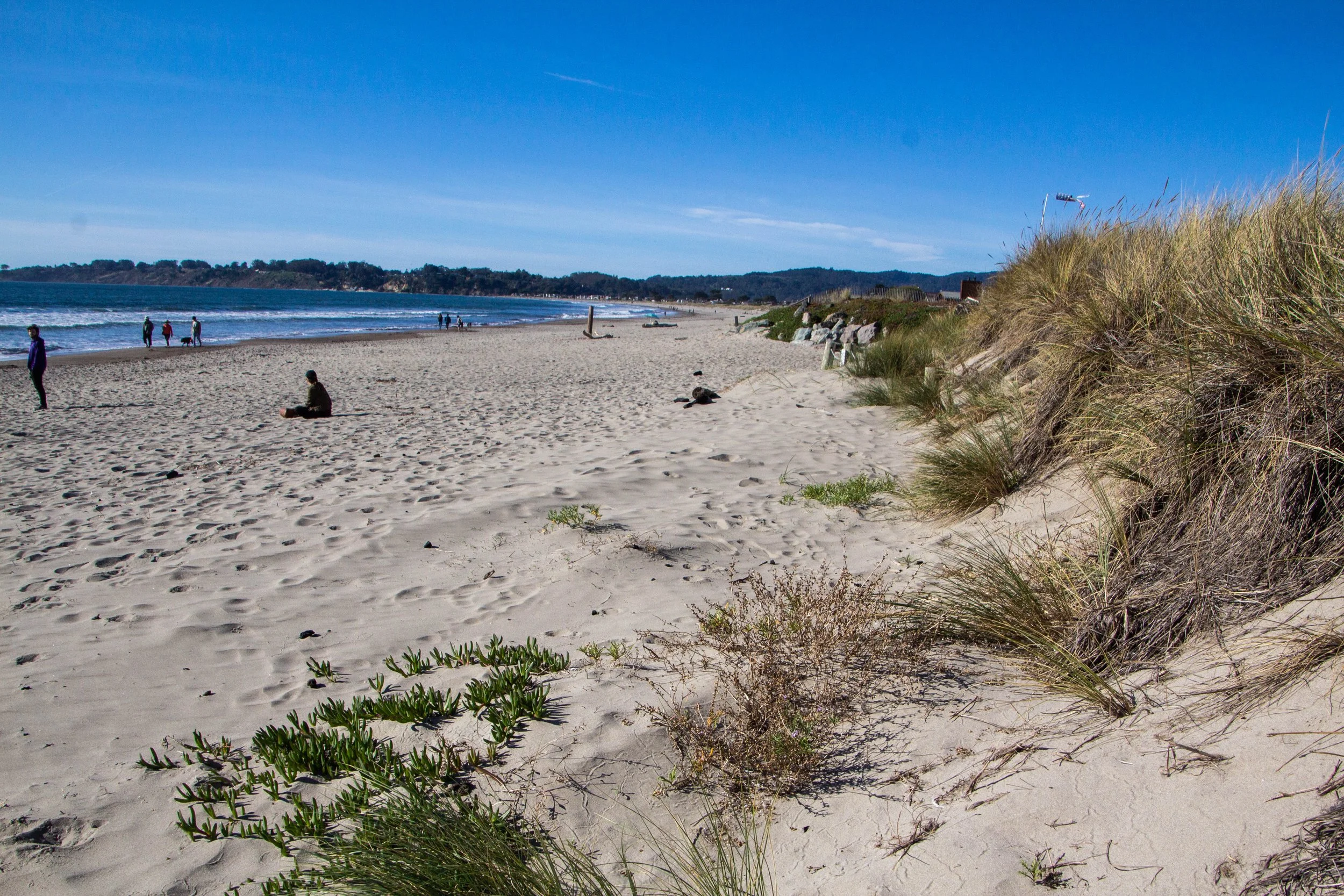
This is the first of 2 articles and I am going to attempt to order these destinations from least to most pretty. Of course, it was all amazing and I’d be happy to teleport back to any one of these scenes right now, but I think the clear starting point here is Limantour Beach. This is a scenic stretch of coastline that runs along the southern side of Point Reyes. It’s a beautiful place, but it was a cold, cloudy day during our visit and I was also quite tired. I got some dramatic pictures, but we didn’t stay here long. It was also a hassle to get down here, and compared to what is coming up next, I’d say the ratio of work to reward here was the least favorable of anywhere we visited. Here are the pictures.


Point Reyes Lighthouse
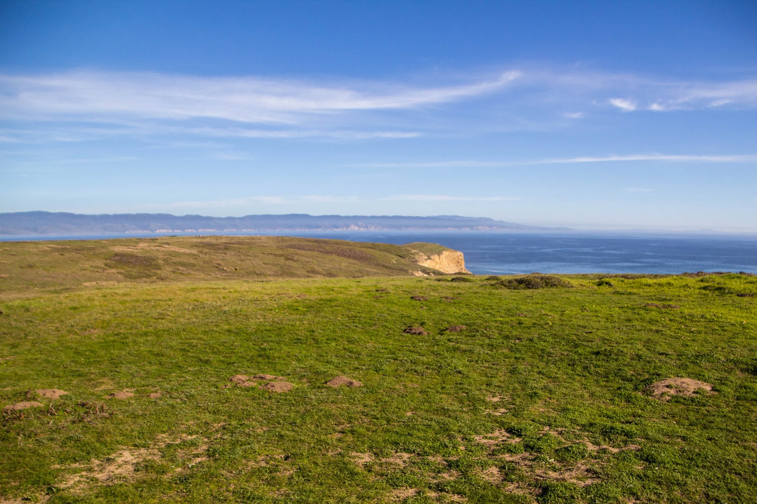
And NOW we’re going to chart a course for somewhere that was truly breathtaking! The Point Reyes Lighthouse and Chimney Rock (labeled ‘B’ and ‘C’ respectively on the map below) are some of the most gorgeous places that the California coastline has to offer, and they are right next to one another. I believe this land formation is collectively called “Point Reyes” — it’s the namesake of this whole area. And It won’t be hard to see why when you see these pictures. The route from our home base in Inverness to Point Reyes is plotted on the map below.
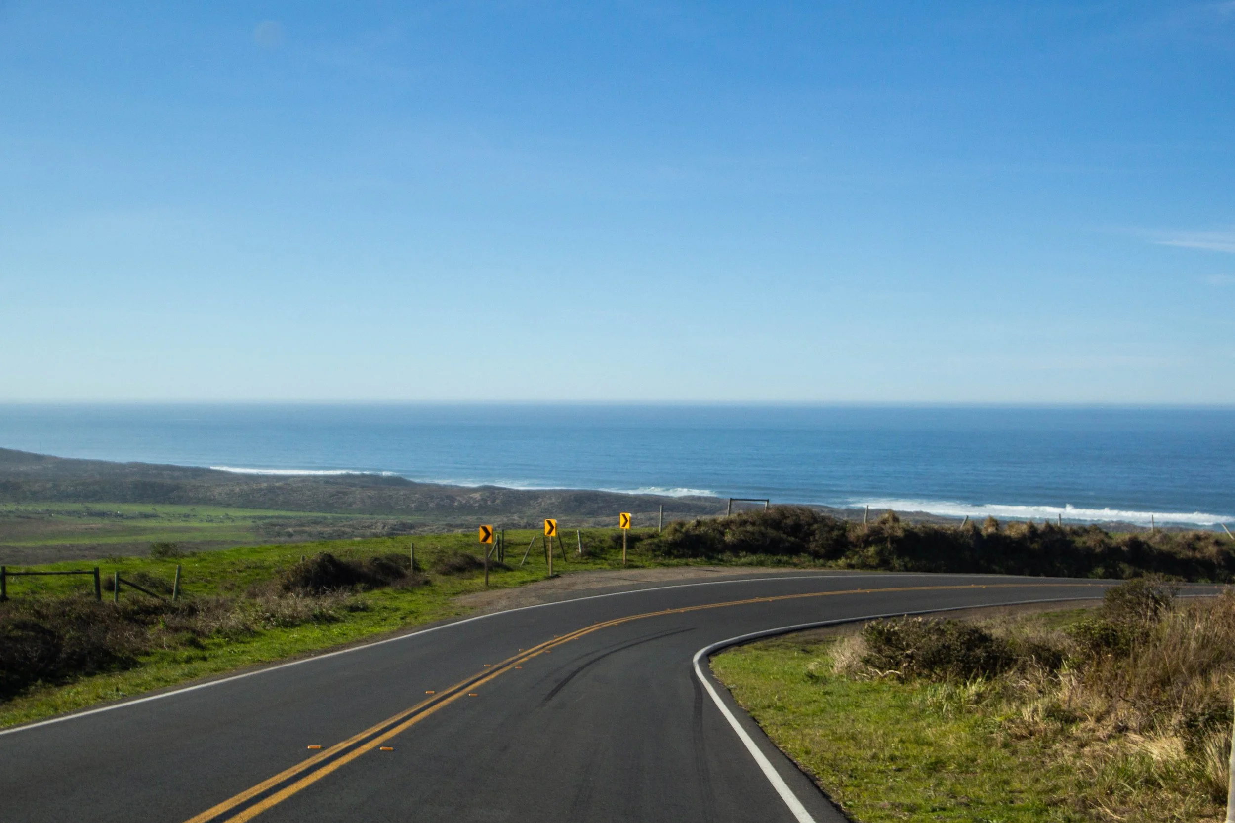
The drive down here was nothing short of stunning. And it was so GREEN. The coastline and the quintessentially-Californian cypress trees were always an obvious indicator of where we were… but there were still moments where this felt more like a drive across Ireland than Point Reyes. Along the way, the only structures were dairy farmers, which have operated out here for generations. The many spotted dairy cows roaming the fields around us definitely added something to the environment, although there was one depressing moment where we drove by the first veal operation I’d ever seen. It was basically just a pasture with a bunch of large, fortified, white boxes. Apparently, each of these boxes had a cow in it. That shit is so inhumane… but I wasn’t going to let it ruin the trip. I did my best to put it out of my mind as we rounded the next scenic vista.


When we arrived at the end of the road, there was a crowded parking lot at the top of a hill. We hopped out of the car and were greeted by clear, sunny skies and the whistling Pacific wind. Looking back up the coast at the landscape we had just traversed was jaw-dropping. And to make it all the more incredible, wild Tule Elk could be seen grazing on the sloping grassy vistas, with all of this as a backdrop. It did not suck.
The hike to the lighthouse took us over one last hill, before landing us at top of one of the longest flights of stairs I’ve ever seen. Apparently, these stairs were the equivalent of climbing 36 stories. It was such a long way, that there were multiple platforms built into the side of the staircase where people could stop to rest. I was still in a long recovery process from a nasty COVID infection that had had me on my ass for the past month, so this was going to be my Everest.
The lighthouse itself was built in 1870 and was/is super important to sailors in this area because the land formation it sits on had apparently been the cause of numerous shipwrecks prior to its construction. And it’s easy to see why. Point Reyes is a rocky, unforgiving land formation that juts WAY out into the open ocean. If you were sailing through this area at night, especially in the fog that the Bay is famous for, this would be an easy place to crash.
Seeing this piece of history was cool, but the whole experience was overshadowed by the grueling return up this flight of stairs. I wasn’t sure how I’d do after COVID, but I made it. I was winded, but I think that the California sun and Pacific air were so life-giving at that point that I could have done a lot more. Catching my breath I walked back along the cliffside, in the shade of the cypress trees, I felt good about the world.


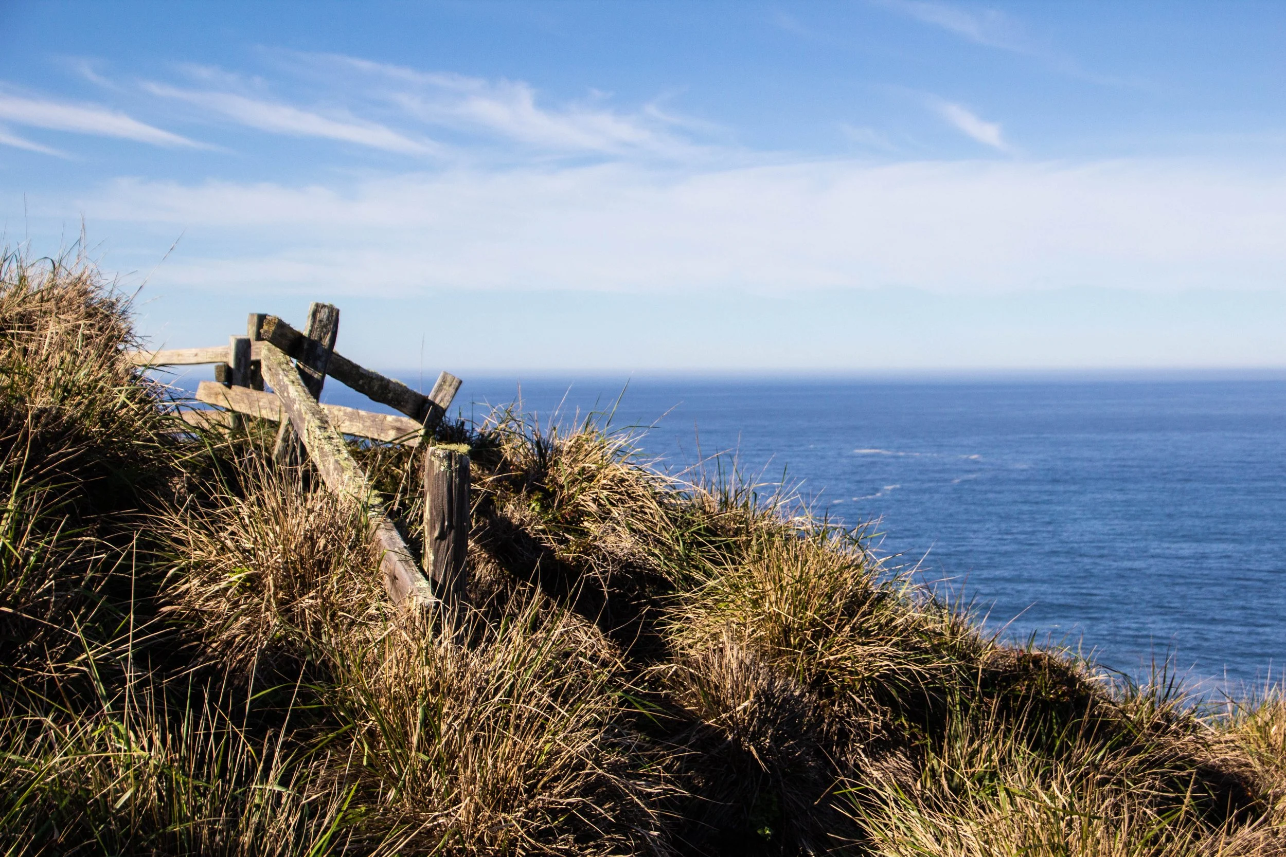


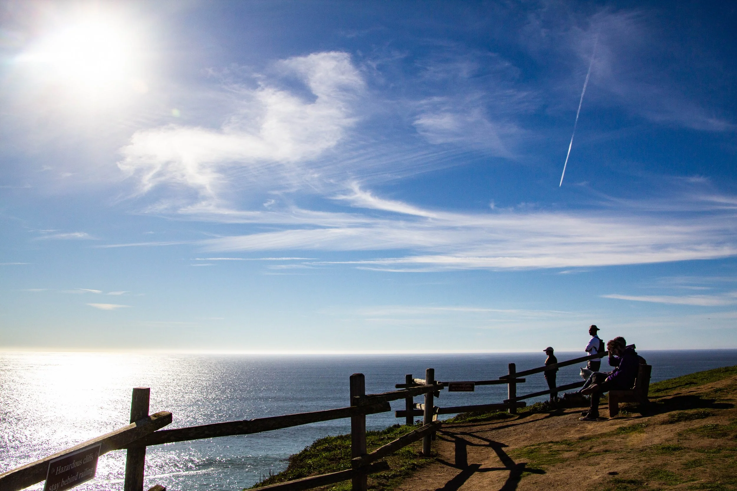
Chimney Rock
Just a short drive down a small road from the Lighthouse’s parking lot is a second, less busy parking lot for the trailhead to a place called Chimney Rock. This, to me, is one of the top 2-3 most stunning places in Point Reyes, and I think you’ll see why. It’s a short hike to get out there (only 1.75 miles or 2.8 km round trip) but it’s action-packed. The hike quickly puts you on gorgeous, windswept fields overlooking 200-foot cliffs, at the bottom of which are sandy beaches packed with seals. Once you get out here, it bears some resemblance to the gorgeous unending tundras of Iceland, but with lots of cool California stuff added into the mix as well.
Once you get out to the end of this trail, there are a few benches where you can sit in the sun and look out at the cliffs snaking their way back towards San Francisco. It’s all just perfect. Sigh. You’ll just need to look at the pictures to understand.


I have to say, the nature in California is next-level. It’s insane to me how close this is to San Francisco. This is an easy weekend trip for anybody in the Bay Area that wants to get away from the city. And as an outsider, it really makes you think—if this is so close to the city, just imagine how much else is out there, farther from the cities! I need to plan a trip to come back and visit Lake Tahoe… and the Red Wood Forests… and Mount Shasta… and Death Valley… and Joshua Tree… and the Lost Coast. There is a LOT to see here.
But the good news is that we’re only halfway through Point Reyes right now! In the next article, we’re going up to the very tip of this place to frolic with the wild elk. Stay tuned for Tomales Point.