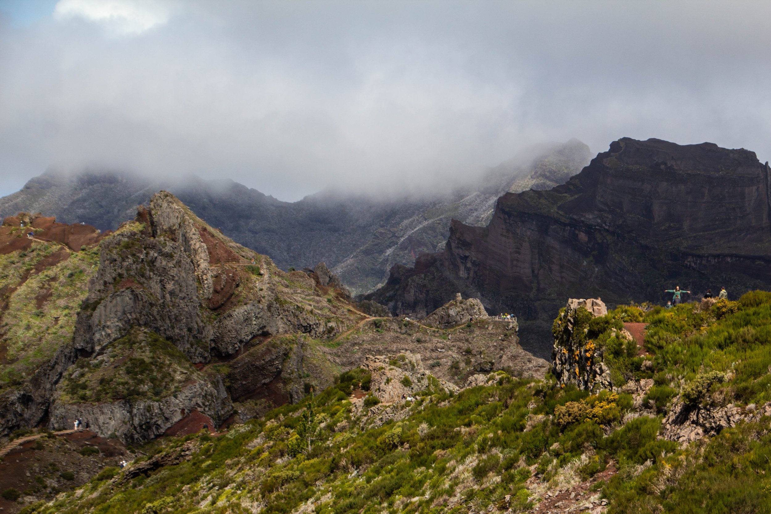
The #1 rated hike in Madeira on AllTrails is the one that from Pico do Areeiro to Pico Ruivo. These are the two highest peaks on Madeira. And in the middle you pass over Madeira’s 3rd highest peak: Pico das Torres. AllTrails ranks this hike as “Hard” and I think most people who do it would agree. But there’s some serious hype around this trek!
“It’s gonna be the coolest hike of your life” my friend said to me confidently after we landed in Madeira.
“…Like, my life specifically?” **Subtext: “You don’t think I’ve done any other cool hikes?” 🥺
“No, dude, like the coolest hike of anyone’s life.”
Literal paradise.
Ushguli is a small cluster of towns that sits right on the Georgia-Russia border in the mountainous northerly region of Svaneti. It’s remote, difficult to access, and it’s got a population of less than 250 people. And yet, a quick Google image search for Georgia (the country of Georgia) will often return images of Ushguli even above images of the capital city. Clearly there is something special about this place.
Svaneti is the highest inhabited region of the Caucasus mountain chain. The whole region is studded with snow-capped 3,000–5,000 meter (~10,000–16,500 foot) peaks and sprinkled with small glaciers. In fact, the highest mountain in Georgia, Mount Shkhara, is located here in Svaneti, which stands at 5,201 meters (17,059 feet) tall. But in between all these mountains and glaciers are some of Georgia’s most picturesque little valleys and towns. These town are inhabited by an ethnic group known as the Svans.
The Westfjords (or, in Icelandic, Vestfirðir), is the name given to the enormous peninsula jutting out from Iceland to the northwest, towards Greenland. In these fjords are some of the most remote places and unforgiving terrain that Iceland has to offer. Only Iceland's interior is more difficult to travel through. After having driven the long road through Sprengisandur, I can personally attest to this. The views we saw from these roads in the Westfjords were absolutely stunning—beautiful enough that I felt that they merited their own article, so here is some of what we saw...
Roaming Nubra Valley are Bactrian camels. When I found this out, I immediately found myself wondering how the hell they got all the way up there. As it turns out, these camels’ ancestors were left over from the legendary Silk Road, which passed through the Nubra Valley on its way to the Orient.
It was another 20 or 30 minutes through the canyon before we finally saw Turtuk off in the distance. As we approached, the canyon grew wider ahead of us, and we saw a small collection of trees. It wasn't long before we were in the middle of those trees, and I was taken completely by surprise by what we found. Tucked away in such a remote part of the Himalayas, Turtuk was like a lot like Shangri-La. Despite its harsh, rugged surroundings, this village was a little slice of heaven.
At 18,380 feet (or 5,602 meters) above sea level, Khardungla Pass is the highest motorable road in the world. To put altitude in perspective for you, that's almost 13 times the height of the Empire State Building. It's a little less than the length of 115 (American) Football fields. It is the equivalent to about 3.5 miles. It is also 780 feet higher than Everest Base Camp.
So let's get into it!


